| Bangladesh |
|
|
 |
|
| Geography | |
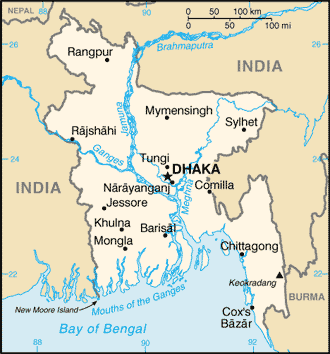
| Location: | Southern Asia, bordering the Bay of Bengal, between Myanmar and India. |
| Area: | total:
143,998 sq km land: 130,168 sq km water: 13,830 sq km |
| Natural Resources: | Natural Gas, Arable Land, Timber, Coal |
| Population and Health | |
| Population: | 163,654,860 (July 2013 est.) |
| Age structure: | 0-14 years: 33% (male 27,393,912/female 26,601,199) |
| Population growth rate: | 1.59% (2013 est.) |
| Birth rate: | 22.07 births/1,000 population (2013 est.) |
| Death rate: | 5.67 deaths/1,000 population (2013 est.) |
| Sex ratio: | at birth: 1.04 male(s)/female |
| Infant mortality rate: | total: 47.3 deaths/1,000 live births male: 49.79 deaths/1,000 live births female: 44.71 deaths/1,000 live births (2013 est.) |
| Life expectancy at birth: | total population: 70.36 years |
| Total fertility rate: | 2.5 children born/woman (2013 est.) |
| Current contraceptive use among married women 15-49 years old(any method): | 61% (2007-2012) |
| Unmet need of contraceptive: | 13.5% (2011) |
| HIV/AIDS - people living with HIV/AIDS: | 8,000 (2012) |
| HIV/AIDS - deaths: | 400 (2012) |
| Literacy: | definition: age 15 and over can read and write |
| Economy | |
| GDP (purchasing power parity): | $324.6 billion (2013 est.) |
| GDP (official exchange rate): | $324.6 billion (2013 est.) |
| GDP - real growth rate: | 5.8% (2013 est.) |
| GDP - per capita (PPP): | $2,100 (2013 est.) |
| GDP - composition by sector: | agriculture: 17.2% |
| Labor force - by occupation: | agriculture: 45% |
| Population below poverty line: | 31.5% (2010 est.) |
| Inflation rate (consumer prices): | 7.6% (2013 est.) |
| Agriculture - products: | rice, jute, tea, wheat, sugarcane, potatoes, tobacco, pulses, oilseeds, spices, fruit; beef, milk, poultry |
| Industries: | jute, cotton, garments, paper, leather, fertilizer, iron and steel, cement, petroleum products, tobacco, drugs and pharmaceuticals, ceramics, tea, salt, sugar, edible oils, soap and detergent, fabricated metal products, electricity and natural gas |
| Industrial production growth rate: | 9% (2013 est.) |
| Exports - commodities: | garments, knitwear, agricultural products, frozen food (fish and seafood), jute and jute goods, leather |
| Currency (code): | Taka (BDT) |
| Fiscal year: | 1 July - 30 June |
| Others | |
| Nationality: | noun:
Bangladeshi(s) adjective: Bangladeshi |
| Religions: |
Muslim 89.5%, Hindu 9.6%, other 0.9% (2004) |
| Languages: |
Bangla (official, also known as Bengali), English |
| Country name: | conventional
long form: People's Republic of Bangladesh |
| Government type: | parliamentary democracy |
| Capital: | name:
Dhaka |
| Administrative divisions: | 7 divisions; Barisal, Chittagong, Dhaka, Khulna, Rajshahi, Rangpur, Sylhet |
| Independence: | 16 December 1971 (from West Pakistan); note - 26 March 1971 is the date of independence from West Pakistan, 16 December 1971 is known as Victory Day and commemorates the official creation of the state of Bangladesh |
| Legal system: | based on English common law |
|
|
|
| Source : UN_Demographic and Health Surveys (DHS), Multiple Indicator Cluster Surveys (MICS) and other national surveys; United Nations Population Division Update date: August 2014 |
|